Join me on my climb up Mount Carleton – New Brunswick’s highest peak at 820 m (2,690 ft). Along the way, I explore Acadian forests, ancient Appalachian geology, and the sweeping views from a historic fire tower that make this mountain both a natural wonder and a personal milestone.
1 Mount Carleton: A Mountain That Calls You Back
ome places you visit once and never return. Others linger in your memory like a half-finished story, calling you back again and again. For me, Mount Carleton – New Brunswick’s highest mountain, is one of those places.
My first trip here was in the mid-1990s on a day-long hiking adventure. The second was in the summer of 2001 for an astronomy event, when I camped under some of the darkest skies in eastern North America. Over twenty years later, I felt the pull once again. I wanted to see how the trail, the summit, and perhaps even I myself, had changed with time.
This June, I set out from Saint John for my third journey to the mountain that many call the “roof of the Maritimes.”
2 Quick Facts about Mount Carleton
- Location: Mount Carleton Provincial Park, northern New Brunswick, Canada.
- Elevation: 820 m (2,690 ft) – the highest peak in New Brunswick and the Maritimes.
- Trail: Mount Carleton Trail, a 9.6 km (6 mi) loop (moderate difficulty, 4 – 6 hours).
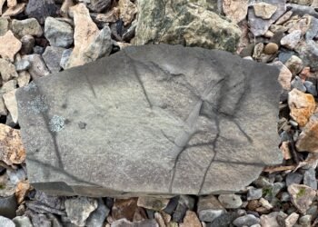
- Geology: Summit composed of rhyolite and basalt volcanic rocks ~400 million years old.
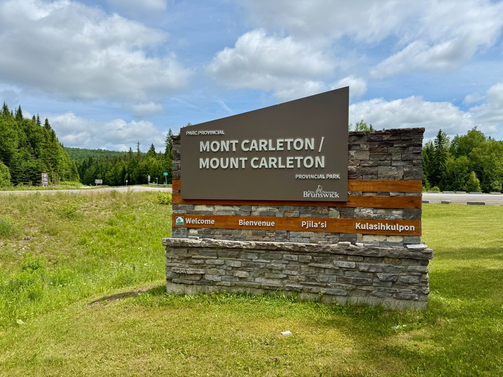
3 Arrival at Mount Carleton Provincial Park
The drive north carried me through rolling farmland along the Saint John River, then into the dense forests of northern New Brunswick. By the time I reached the park entrance just past lunch, the air felt cooler, fresher, and heavy with the scent of spruce.
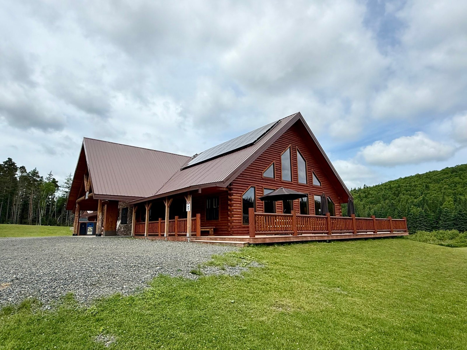
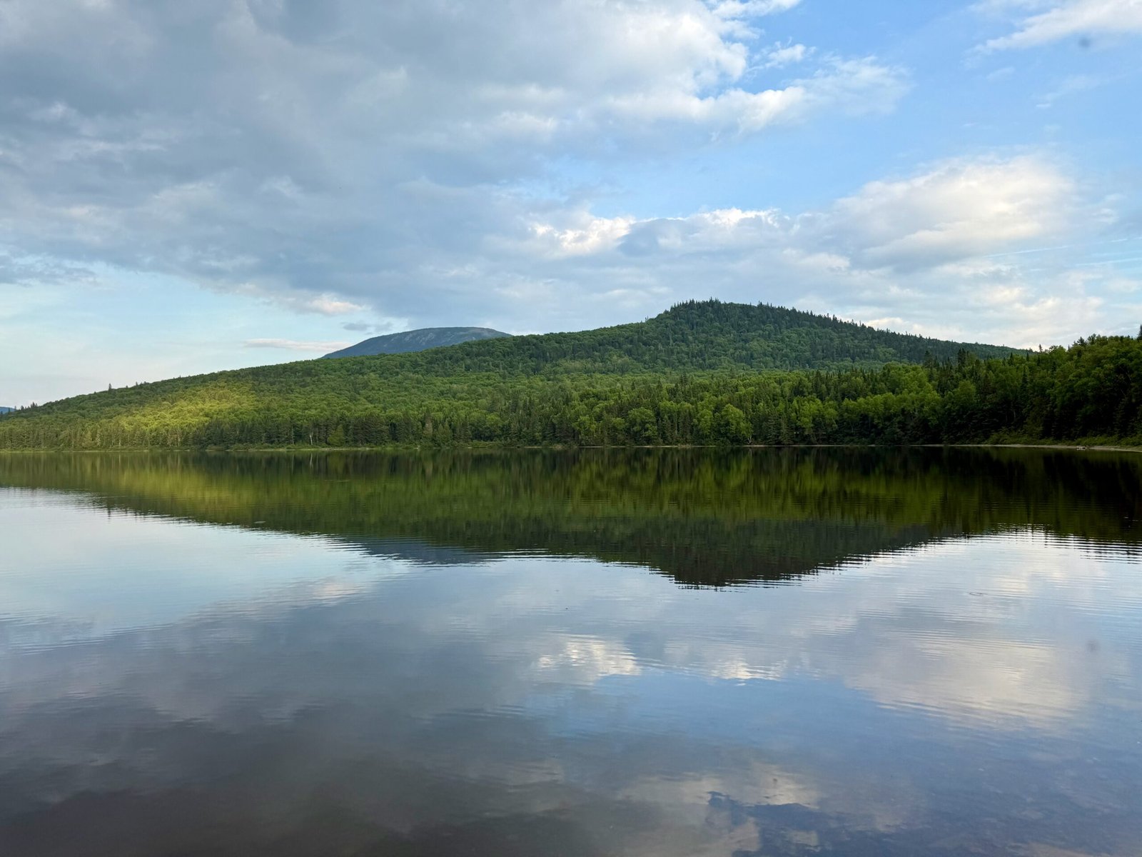
After checking in at the park entrance, proceeded on to the Mount Carleton Lodge Café. From its deck, the view across Nictau Lake to the mountain is enough to stop you in your tracks. I sat down for lunch but ended up staying far longer than planned, mesmerized by the play of light on the water and the imposing silhouette of the mountain I would soon climb.
It struck me then that this wasn’t just a hike – it was a pilgrimage back to a place where natural history and personal history meet.
4 Driving to the Trailhead
From the lodge, it’s about a 11 km drive to the Mount Carleton Trailhead. The gravel road winds through the heart of the park, past forest stands where moose often feed at dusk. By the time I arrived, the parking lot was nearly full. Clearly, I wasn’t the only one answering the mountain’s call that day.
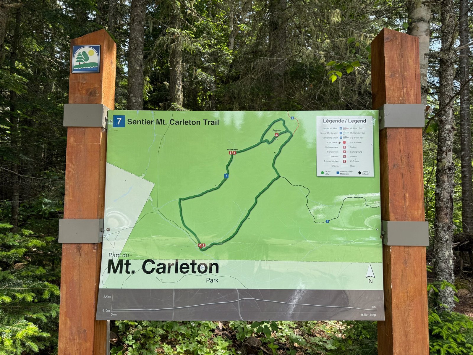
The Mount Carleton Trail is a 9.6 km (6 mi) circular loop. You can hike it clockwise or counterclockwise. I couldn’t recall which way I had gone two decades ago, so I chose to go clockwise, a decision I’m glad I made.
5 Into the Acadian Forest
The trail began gently, leading me through the Acadian forest. Unlike the boreal forests further north, the Acadian mix is diverse: spruce, balsam fir, birch, sugar maple, and beech. Sunlight filtered through the leaves, dappling the ground in shifting patches of green.
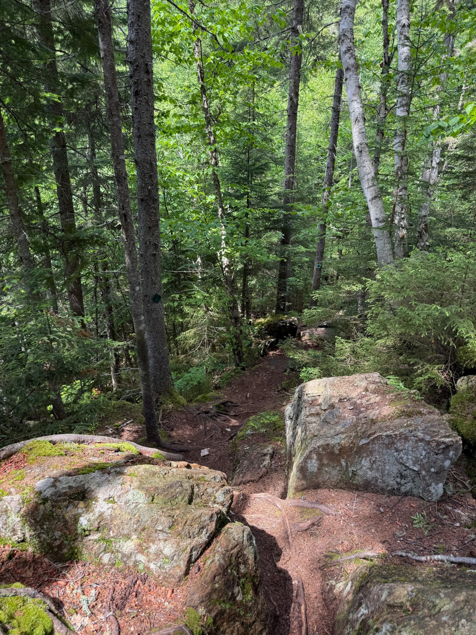
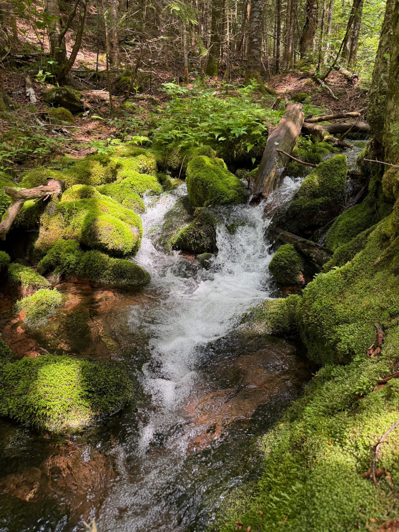
Soon, I found myself walking alongside a lively brook, tumbling down from the mountain. I stopped for a moment just to listen – the rush of water over stone, the gentle wind through the trees, and the occasional bird call. It’s a soothing soundtrack, a reminder of why so many people come here not just to hike, but to reconnect with something elemental.
6 You Might Also Like:
- The Fundy Trail: Exploring New Brunswick’s Coastal Highlands – Hike along dramatic cliffs shaped by the Bay of Fundy and carved from the Appalachian Mountains.
- Mount Katahdin: Hiking Maine’s Highest Peak – Discover the rugged geology and sweeping views of New Brunswick’s Appalachian neighbor to the south.
- Mount Washington, NH: Science and Weather on New England’s Highest Summit – Explore the geology and extreme weather of the tallest peak in the White Mountains.
7 The Science Beneath My Feet
As I climbed, I couldn’t help but think about the deep history beneath my shoes. Mount Carleton is part of the Appalachian Mountain chain, a system that stretches over 2,400 km (1,500 mi) from the province of Newfoundland all the way down to the state of Georgia. Today, these ridges are worn and rounded, but hundreds of millions of years ago they were as tall and dramatic as the Himalayas.
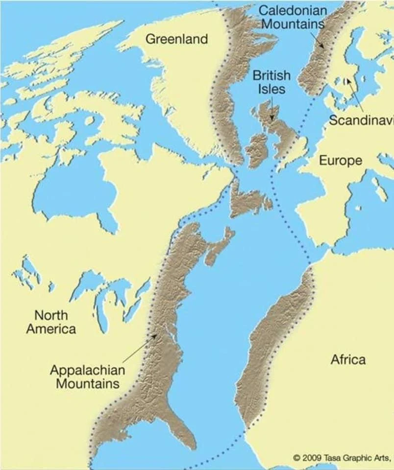
The Appalachians formed during a series of continental collisions more than 400 million years ago. The rocks at Mount Carleton – jagged rhyolite and basalt at the summit, are remnants of intense volcanic activity that accompanied the collision of ancient landmasses. Back then, this region was stitched into the heart of the supercontinent Pangea, when North America, Africa, and Europe were locked together in one massive landmass.
But mountains, like stories, evolve. When Pangea began to break apart around 200 million years ago, the land that is now Atlantic Canada shifted to the edge of a growing ocean basin. Erosion gnawed at the once-towering peaks, carving them down into the rounded highlands we hike across today. Later, during the last Ice Age, glaciers nearly a kilometre thick scoured across these mountains, smoothing valleys, shaping ridges, and leaving behind the rugged but softened landscape we see now.
Every step on the trail felt like a journey through time, from fiery volcanic origins, through the crushing weight of ice, to the quiet forested slopes of today’s Mount Carleton.
8 A Mountain with History
Long before hikers climbed its trails, Mount Carleton held significance for the Mi’kmaq and Wolastoqiyik peoples, who knew these highlands as part of their ancestral homelands. The mountain’s streams feed three major watersheds, earning it the nickname the “water tower of New Brunswick.”
The mountain was later named after Sir Guy Carleton, Governor of Quebec and Governor General of British North America in the late 1700s. Carleton, who later became Lord Dorchester, played a key role in Canada’s early colonial history, and his name endures across the region.
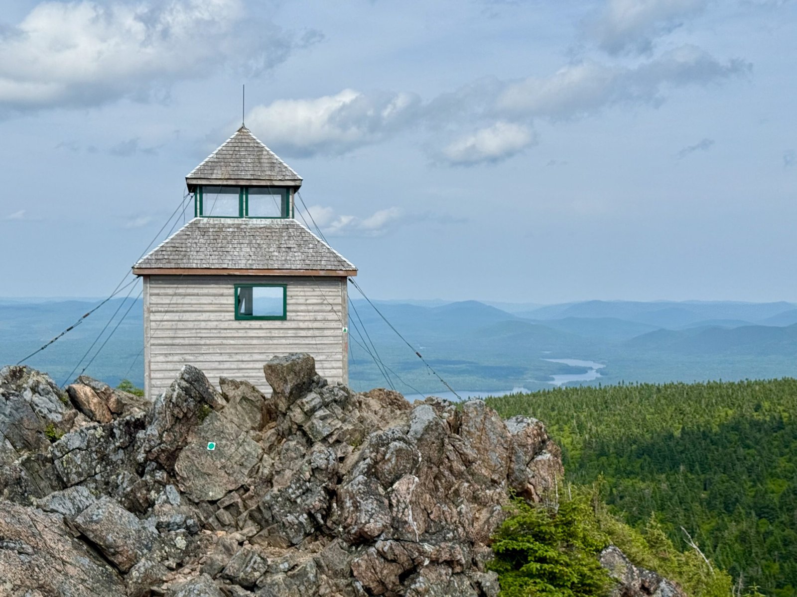
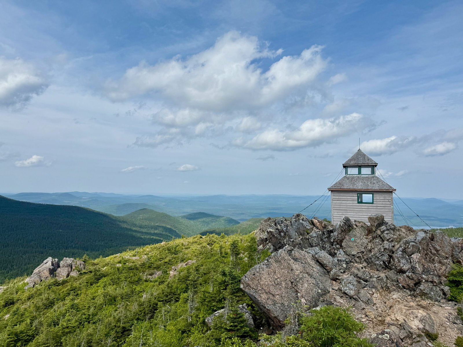
In the 20th century, the summit became a strategic point for forest fire detection, and the wooden fire lookout tower was built in 1923 and is still standing as a historic marker today.
The provincial government recognized the ecological and cultural value of the region in 1970, when Mount Carleton Provincial Park was created, protecting more than 42,000 hectares (~104,000 acres) of Acadian forest, lakes, rivers, and highlands. Since then, it has become a haven for hikers, campers, and stargazers, and a cornerstone of New Brunswick’s protected wilderness.
9 The Climb Becomes Steeper
After about an hour, the trail began to rise more sharply. Roots tangled across the path, and the air grew cooler. My legs burned, but the promise of the summit kept me moving.
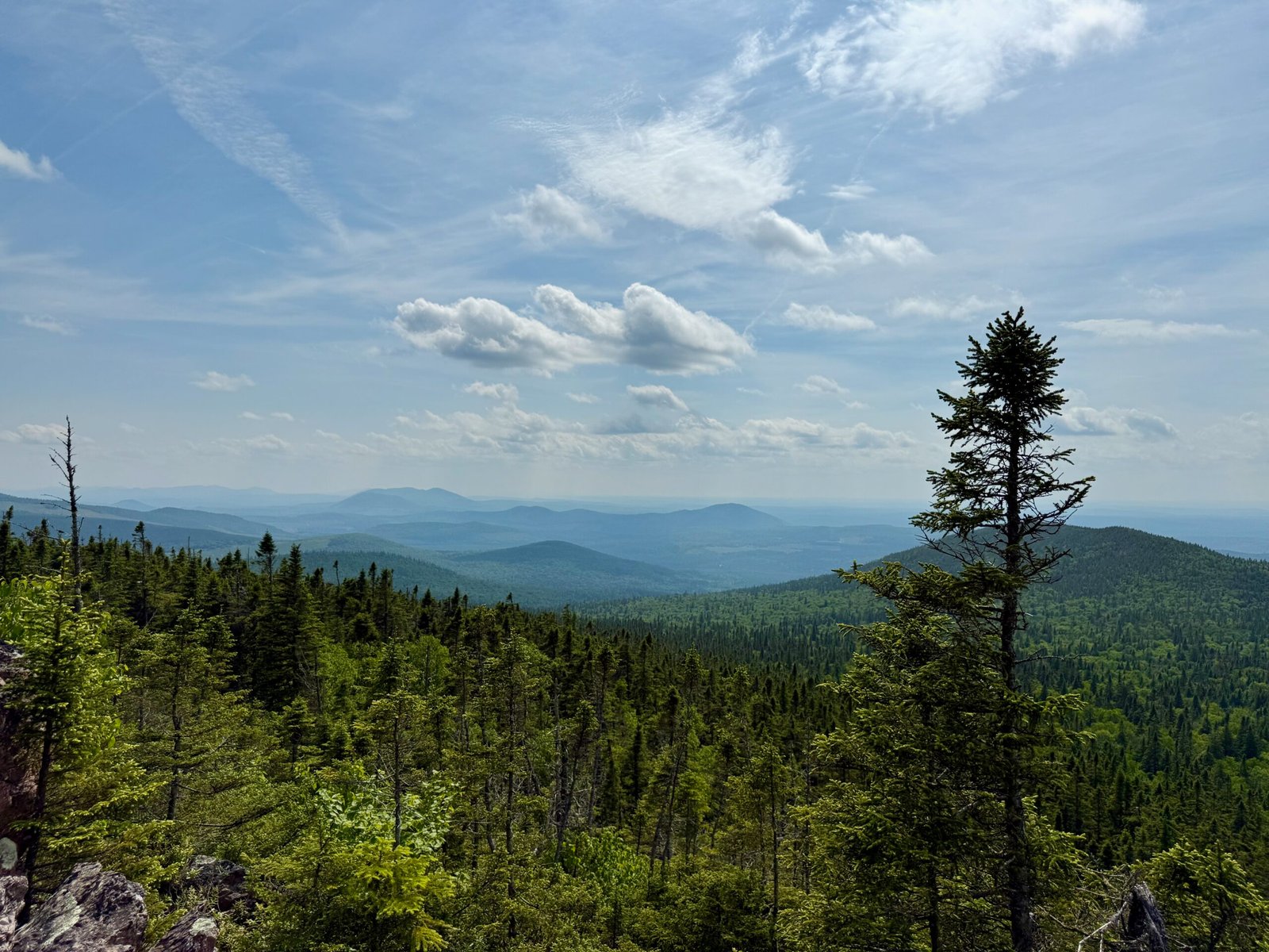
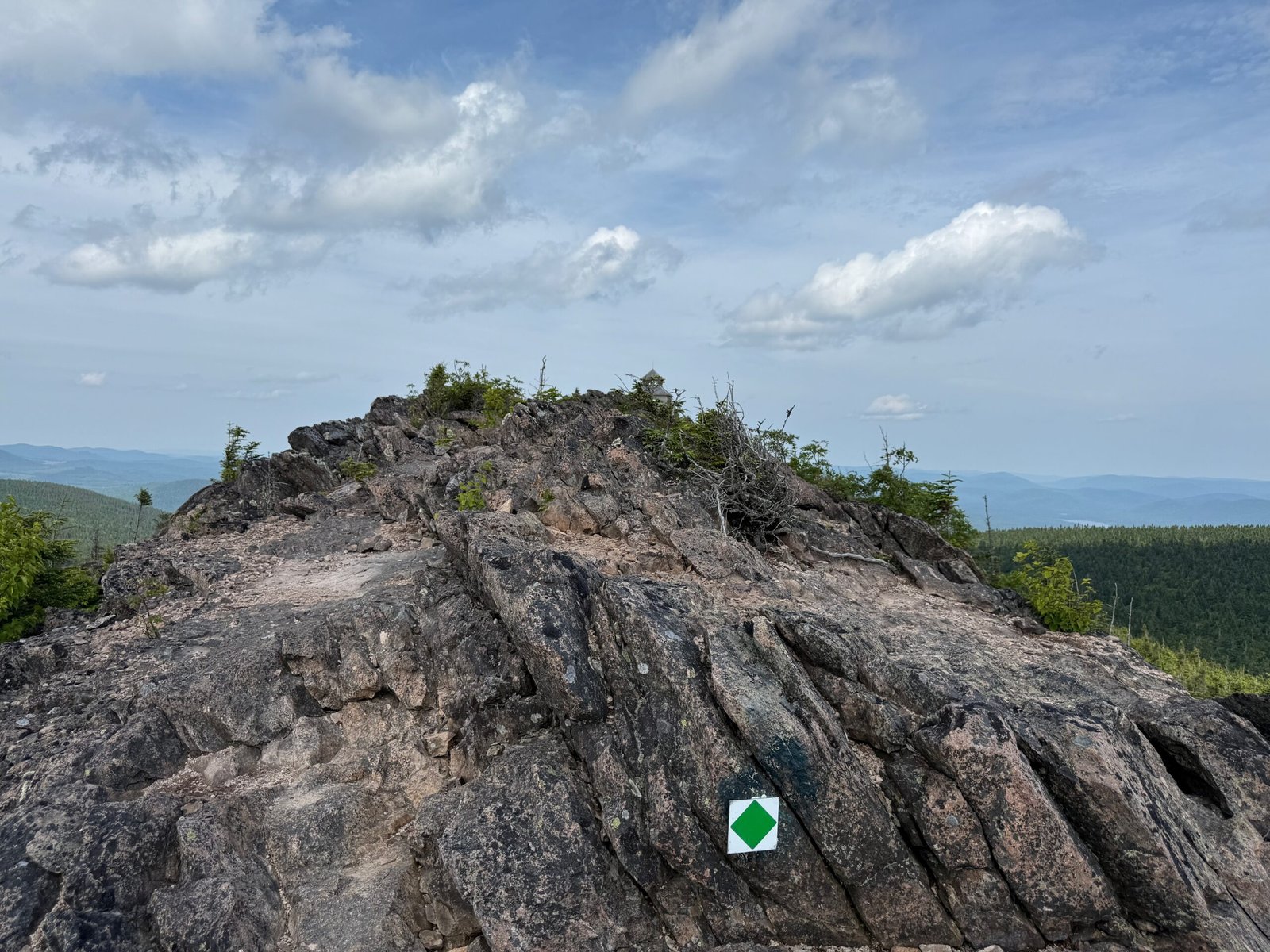
Breaking through the tree line, the views suddenly opened up. To the south and west, the Appalachians stretched into the distance, a patchwork of green ridges fading into blue haze. It was humbling to think that I was standing on some of the oldest mountains in the world – their jagged peaks long since eroded, yet still majestic in their quiet way.
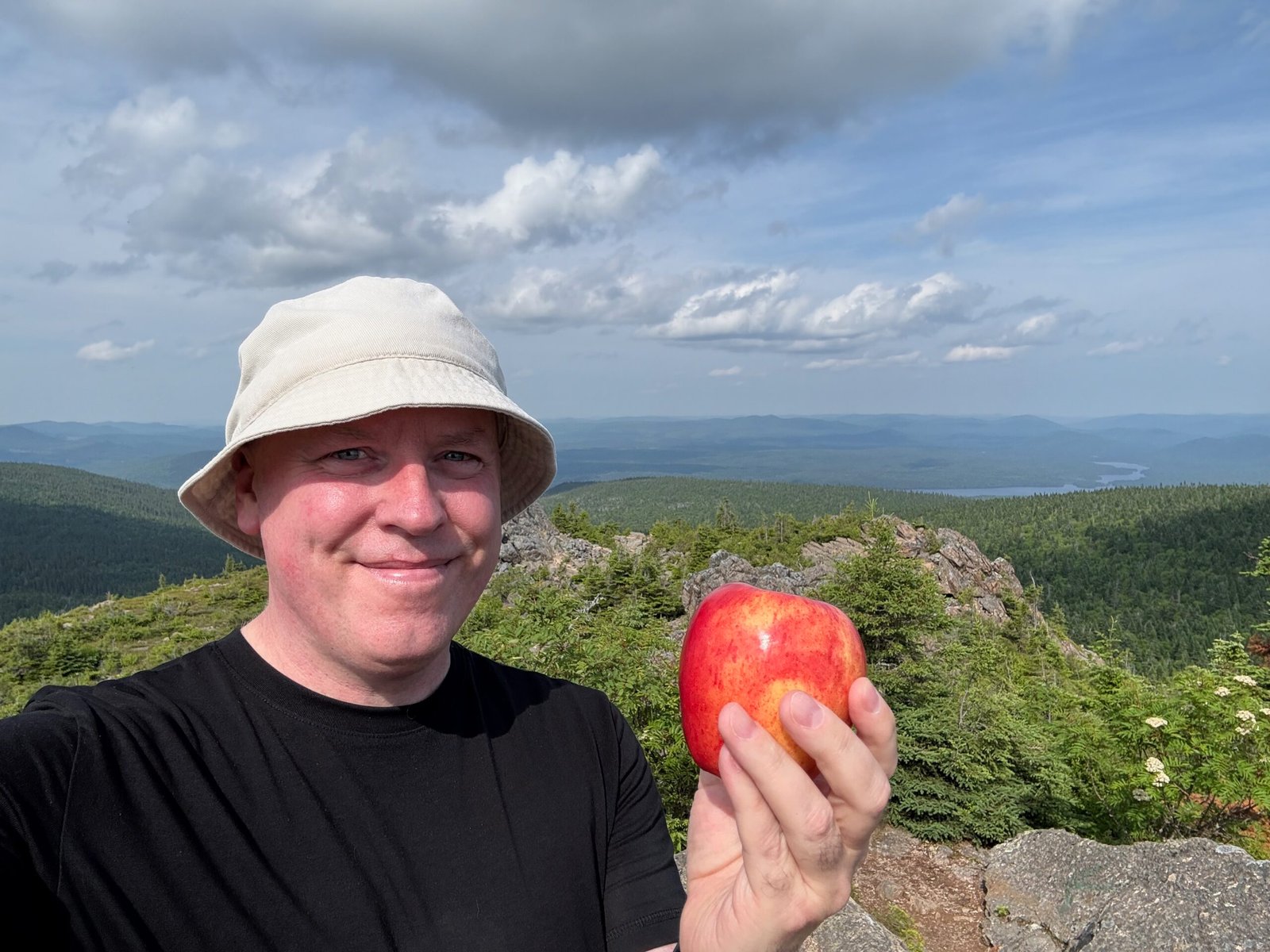
By 4:38 pm, after a few water breaks and countless photo stops, I reached the summit.
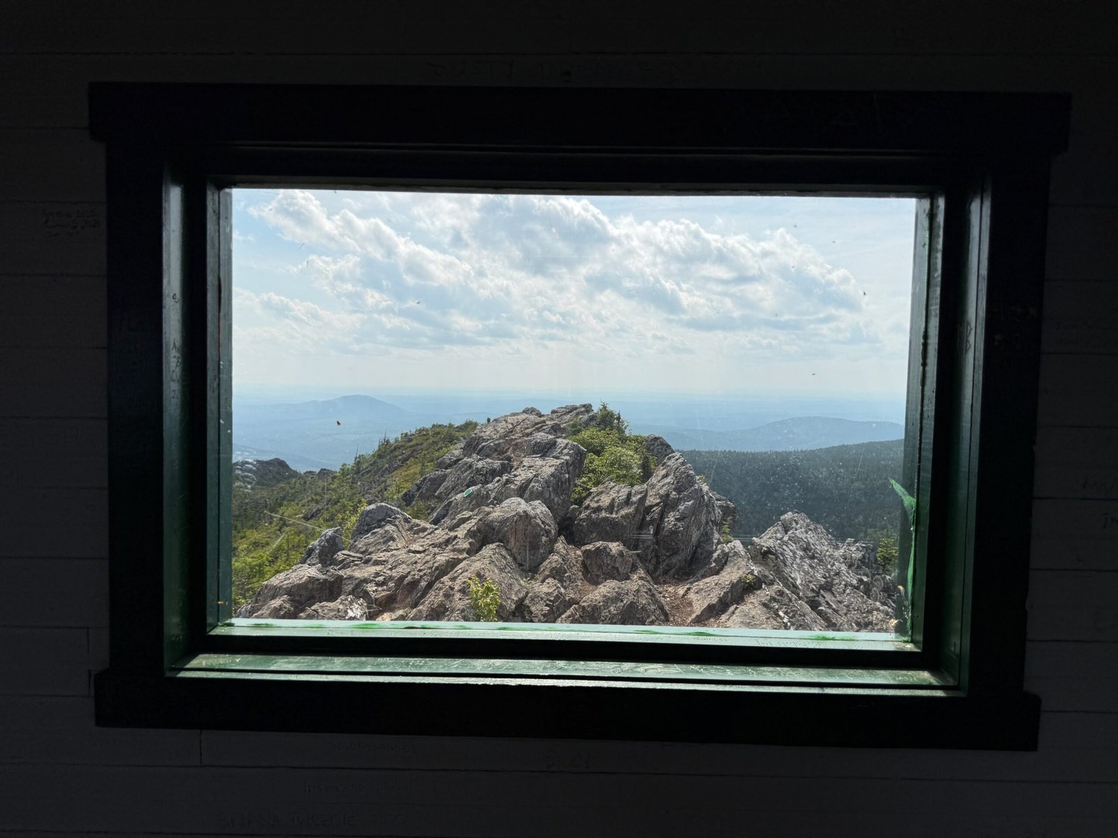
10 At the Summit: A Fire Tower and a Window into Time
The first thing that greets you at the top is the wooden fire lookout tower, perched on the peak. I remember seeing it on my first hike back in the ’90s, and it felt like an old friend, weathered but steadfast.
Nearby, an information placard notes that on a clear day, you can see up to 65 km (40 mi) from here. That day, the air was crystalline, and the horizon seemed to stretch endlessly.
Looking down, I was struck by the sight of Nictau Lake, a long ribbon of water snaking between the mountains. From above, it seemed to stretch on forever, glinting in the sunlight and framed by ridges of the northern Appalachians. The lake looked almost like a fjord carved into the highlands, a reminder of the glaciers that once filled these valleys during the last Ice Age.
I sat down on the jagged volcanic rocks, my snack in hand, and let my imagination wander. What did this view look like 20,000 years ago, when an ice sheet nearly a kilometre thick buried everything in sight? What did it feel like 400 million years ago, when lava flowed across the land as Pangea was alive with tectonic upheaval?
Science has a way of turning even the most peaceful summit into a time machine.
11 The Descent Back to the Valley
Going down was much quicker than expected. After a short descent, the trail joined an old woods road that guided me back toward the parking lot. By 6:17 pm, I was back where I started – tired but exhilarated. The once-busy lot was now nearly empty, and I felt a private sense of accomplishment. I pulled out a long, cool drink and savored every drop. The day had been hot, my water nearly gone, and that small indulgence tasted like pure reward.
12 Evening at Nictau Lake and Armstrong Campground
I drove back to the Lodge Café for one last look at Nictau Lake. Though the café had closed for the evening, I lingered by the shore, watching the evening light fade over the water.
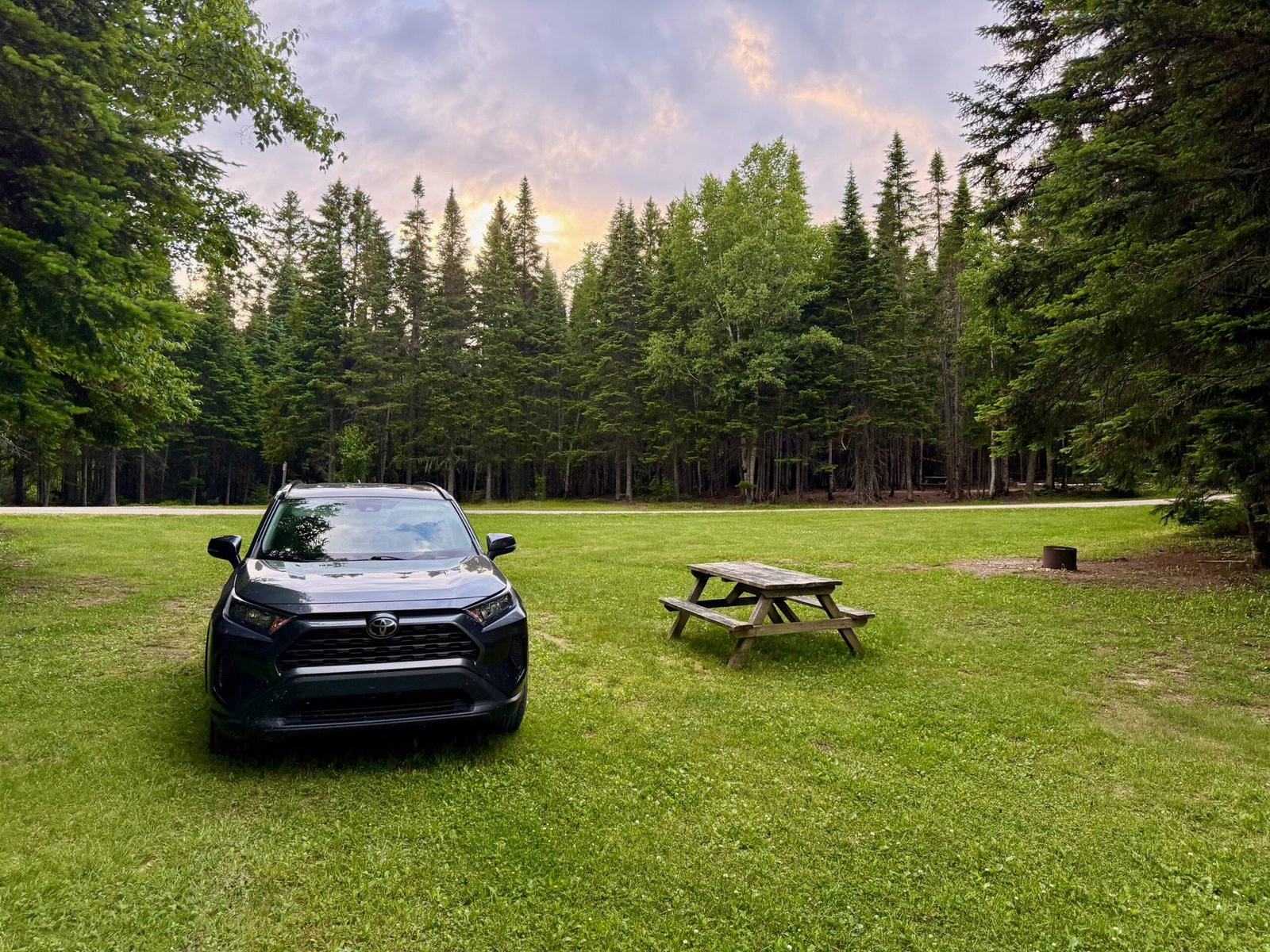
By 8:00 pm, I reached my tent campsite at the Armstrong Campground. It was everything a camper could want – grassy, shaded, and peaceful. But as dusk settled, so did the mosquitoes. Rather than spend the evening swatting, I saw an opportunity. With my hike behind me and another adventure calling, I packed up and drove north to Campbellton, eager to get an early start on my next quest: fossil hunting along the Restigouche River.
Still, I knew I would return. Mount Carleton is part of a designated Dark-Sky Preserve, and in late summer or fall I plan to bring my telescope back to Armstrong Campground to enjoy the brilliance of the Milky Way and the starlit skies above New Brunswick’s highlands.
13 Practical Travel Tips for Mount Carleton
Here’s what you need to know before hitting the trail and exploring the park.
- Getting There: Mount Carleton Provincial Park is about 4.5 hours by car from Saint John, 3.5 hours from Moncton or 3 hours from Fredericton. The nearest town with services is Saint-Quentin.
- Trail Info: The Mount Carleton Trail is a 9.6 km loop. Moderate difficulty, with some steep sections near the summit. Allow 4–6 hours.
- What to Wear/Bring: Sturdy hiking boots, layered clothing for changing weather, insect repellent in summer, water (at least 2L), and snacks.
- Elevation: 820 m (2,690 ft), making it the highest peak in the Maritimes. Weather can be cooler and windier at the top.
- Park Season: Mount Carleton Provincial Park is typically open from mid-May to mid-October. Exact dates vary by year and weather conditions.
- Admission: Around $13 (2025) per vehicle per day (discounted rates for New Brunswick residents, youth, and seniors). Seasonal passes are also available.
- Camping: The park offers several campground and cabin sites. Check the park website for prices and availability.
- Facilities: Mount Carleton Lodge Café offers meals, Wi-Fi, and incredible views of Nictau Lake. Limited amenities in the park.
- Connectivity: Limited cell coverage in most of the park. Some reception at the summit; Wi-Fi at the Lodge Café.
- Best Season: Late summer to early fall for cooler temperatures, fewer mosquitoes, and clearer skies. Winter access is possible for snowshoeing.
14 Pro Tips for the Science Traveler
Here are some small details that help turn a good hike into a science-filled adventure.
- Geology Watch: At the summit, look for jagged rhyolite and basalt – remnants of ancient Devonian volcanism when this region was part of supercontinent Pangea.
- Forest Ecology: Notice the transition from mixed Acadian forest at lower elevations to boreal species near the summit – a miniature ecological journey.
- Appalachian Heritage: The rolling ridges you see stretching into the distance are part of the Appalachians, once towering like the Himalayas before erosion wore them down.
- Dark-Sky Preserve: If you stay overnight, Mount Carleton is within a designated Dark-Sky Preserve – a rare chance to observe the Milky Way without light pollution. Perfect for astronomy enthusiasts.
- Map Curiosity: Note how the streams radiating from Mount Carleton feed multiple watersheds – it’s sometimes called the “water tower of New Brunswick.”
-
- Southward: Into the Saint John River system (flowing to the Bay of Fundy).
- Northward: Into the Restigouche River system (flowing to Chaleur Bay / Gulf of St. Lawrence).
- Eastward: Into the Miramichi River system (flowing to the Gulf of St. Lawrence).
-
15 FAQs About Mount Carleton
How tall is Mount Carleton?
Mount Carleton stands at 820 m (2,690 ft) above sea level – the highest peak in New Brunswick and the Maritimes.
Is Mount Carleton part of the Appalachian Mountains?
Yes. It belongs to the ancient Appalachian Mountain chain, which stretches from Newfoundland all the way to Georgia, USA.
How long is the Mount Carleton Trail and how hard is it?
The Mount Carleton Trail is a 9.6 km (6 mi) loop rated moderate, with some steeper sections near the summit. Most hikers take 4 – 6 hours round-trip.
When is Mount Carleton Provincial Park open?
The main season runs from mid-May to mid-October for hiking and camping. In winter the park is accessible for snowshoeing.
How much does it cost to visit and camp?
A daily vehicle pass is about $12 (discounted for NB residents, youth, and seniors). Campsites at Armstrong and Headwaters campgrounds cost roughly $30–$35 per night in summer.
Why is Mount Carleton called the “water tower of New Brunswick”?
Streams from the mountain flow into three major river systems, including the Saint John, Restigouche, and Miramichi Rivers, sending water in different directions across the province.
Can you stargaze at Mount Carleton?
Yes! The park is part of a designated Dark-Sky Preserve, making it one of the best spots in Atlantic Canada for stargazing and astrophotography.
16 Reflection: Why Mount Carleton Matters
Climbing Mount Carleton is more than just a hike. It’s an encounter with geology, ecology, and history all at once. It’s also a place of astounding natural beauty – from Nictau Lake shimmering far below to the rolling ridges of the Appalachians fading into the horizon. Here, science and scenery intertwine, making every step both a lesson and a wonder.
For me, this second climb and third visit felt like closing a circle – a reunion with a mountain that has been part of my story for decades. For anyone who loves science, travel, or simply the thrill of standing on a summit, Mount Carleton Provincial Park is an incredible place that will stay with you long after you’ve left its trails behind.
Some links in this story are affiliate links. If you choose to buy through them, Curious Don may earn a small commission – at no extra cost to you. It helps support more science travel stories like this.